B.CEAP
Ideas competition for the upgrading and development of the mining site of Corio and Balangero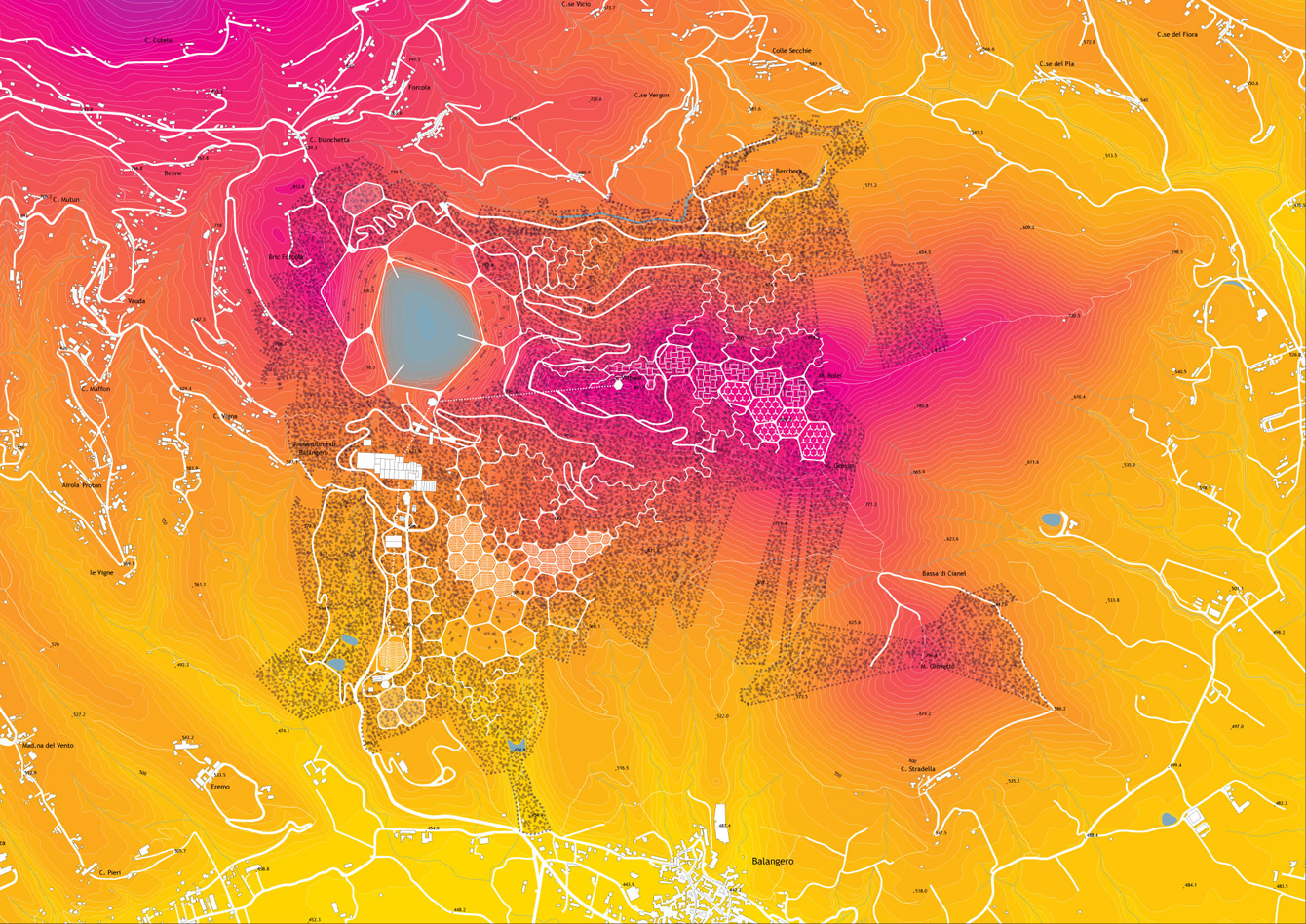
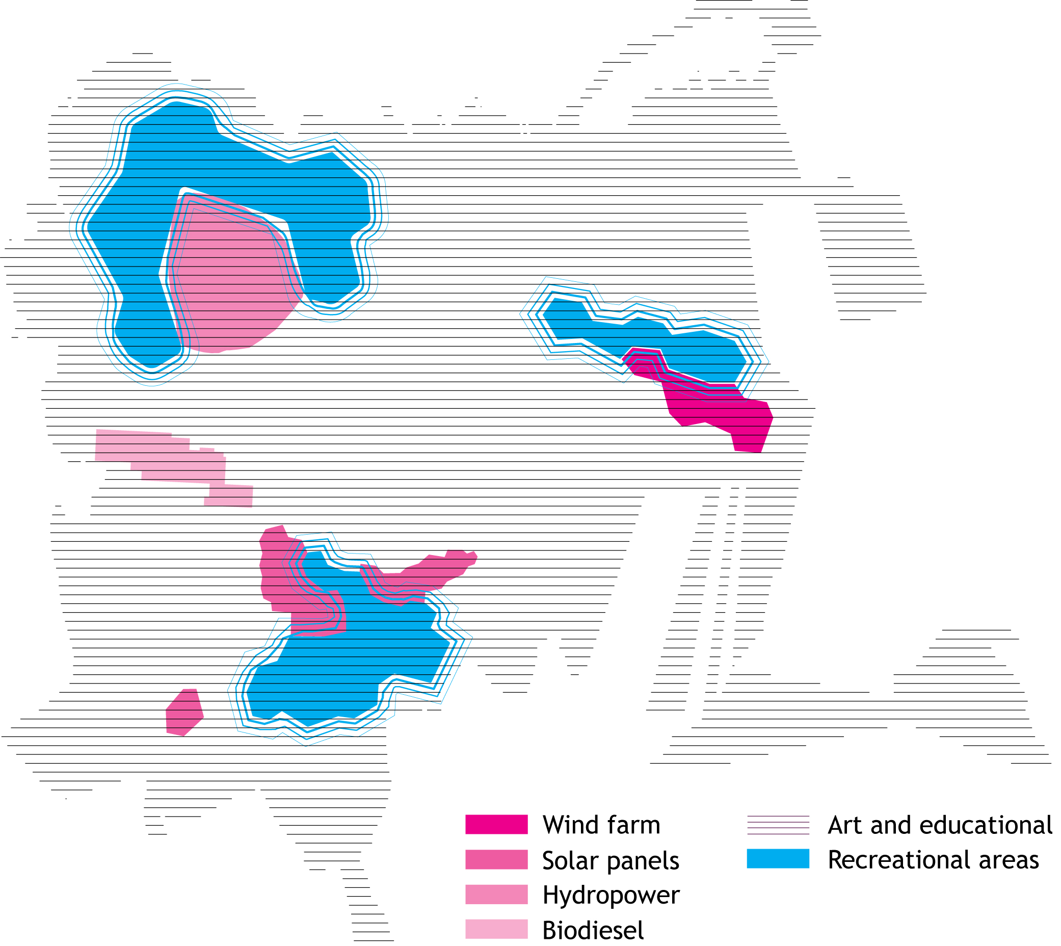
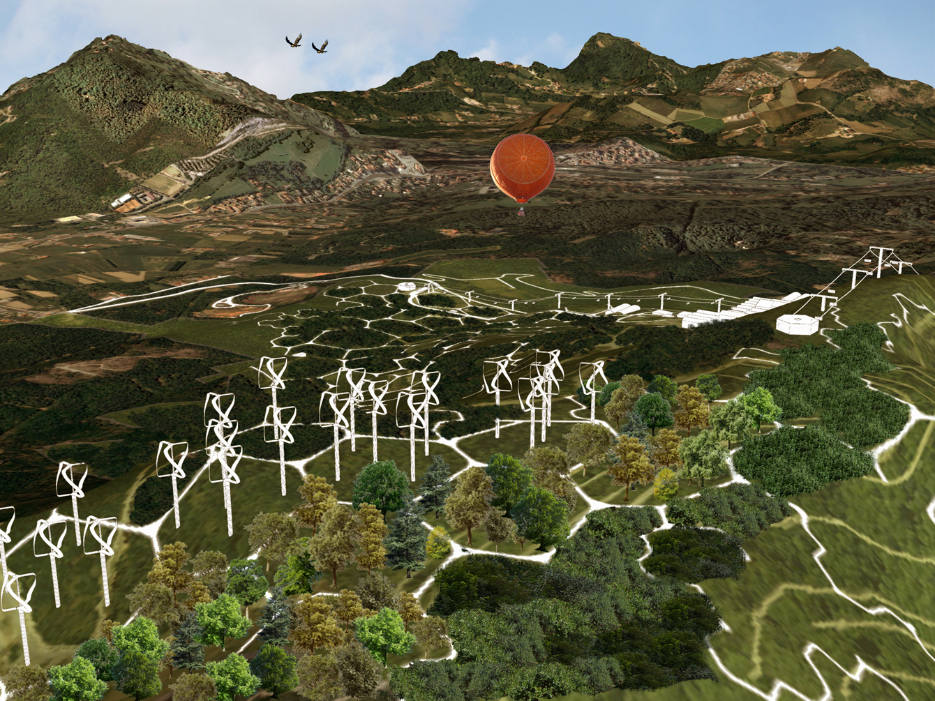
Program Landscape regeneration (decontamination of the asbestos mining site and of the former asbestos processing buildings, renaturalization of the area) and Economy regeneration ("Balangero and Corio Energy Art Park": widespread art museum and educational center for contemporary art, renewable power stations, research and educational center for renewable energy)
Team Valerio Franzone, 3C+T Capolei Cavalli A.A., Studio A&P Architetura del Paesaggio
Client RSA srl, Ministero dell’Ambiente, Regione Piemonte
Collaborators Alvise Chevallard (contemporary art and teaching programs), Peter M. Van Den Dorpel - Algaelink N.V. (renewable energy), Modimar s.r.l. (hydraulic engineering)
Location Balangero and Corio (Turin), Italy
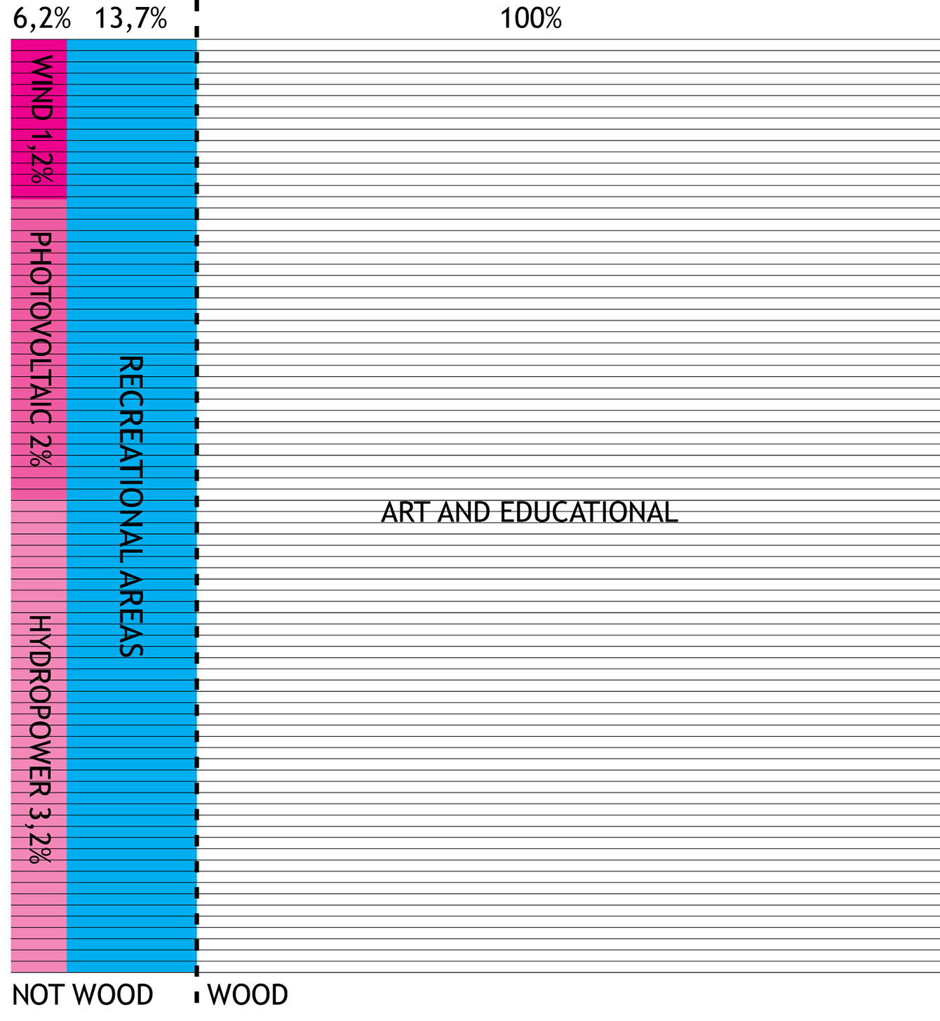
Area outdoor 310 ha; built 40.000 m2
Year 2011
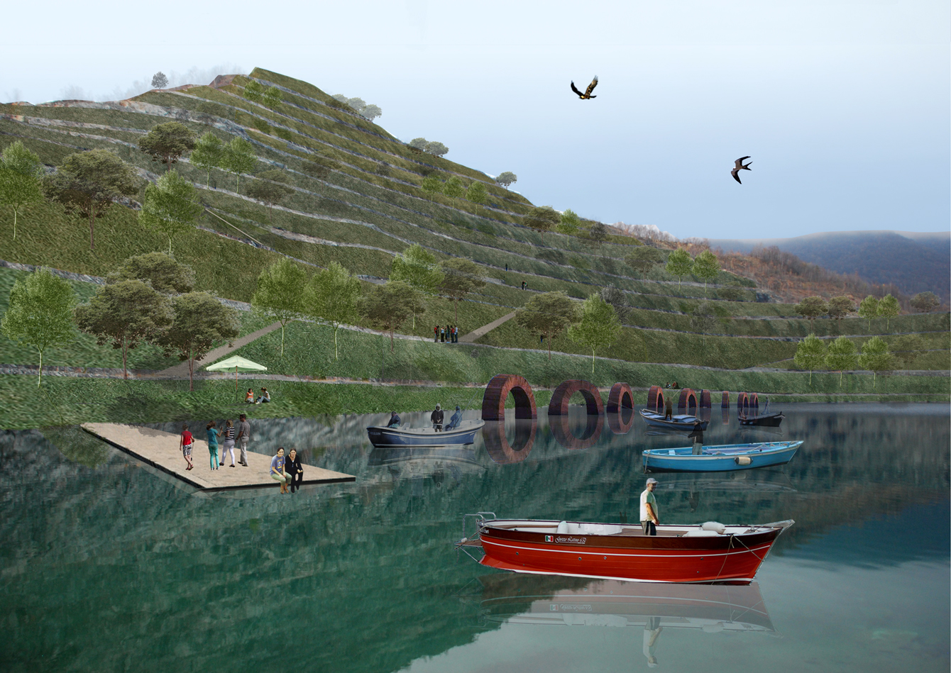
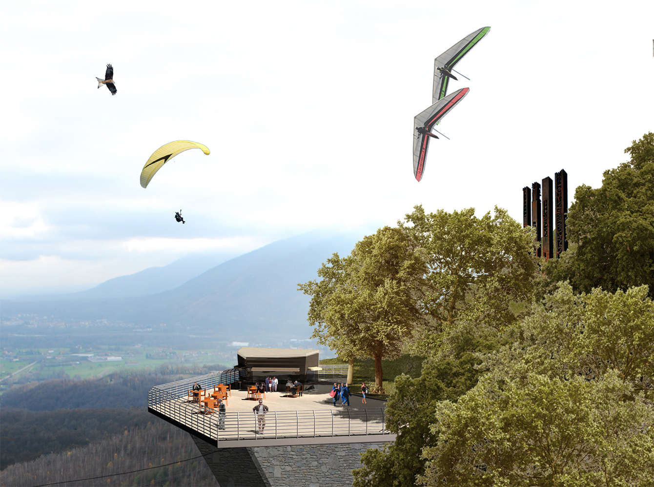
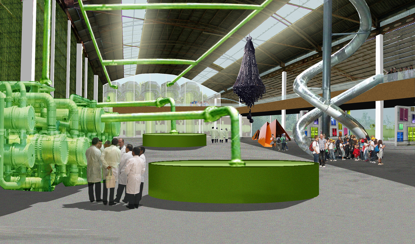
B.CEAP - Balangero and Corio Energy Art Park is the ultimate frontier in the panorama of local economic and natural regenerations thanks to its mixed program composed of research, production, teaching, and exhibiting functions.
The strategy starts from the regeneration of the former asbestos mining site and processing buildings, continues with the re-naturalization of the site, and ends with the creation of an international pole for contemporary art and sustainable energy development.
Driven by the aim to revitalize what once was an economy with international relevance, the program is based on a whole new set of functions: an Alpine natural park, a contemporary art center offering residence programs to young and well-known artists, a widespread art museum, a research and production center for sustainable energies, a widespread scientific museum about sustainable energies.
In order to enhance the visitors' experience and the research outcomes, the spaces hosting the different functions are often not strongly divided but overlapping.
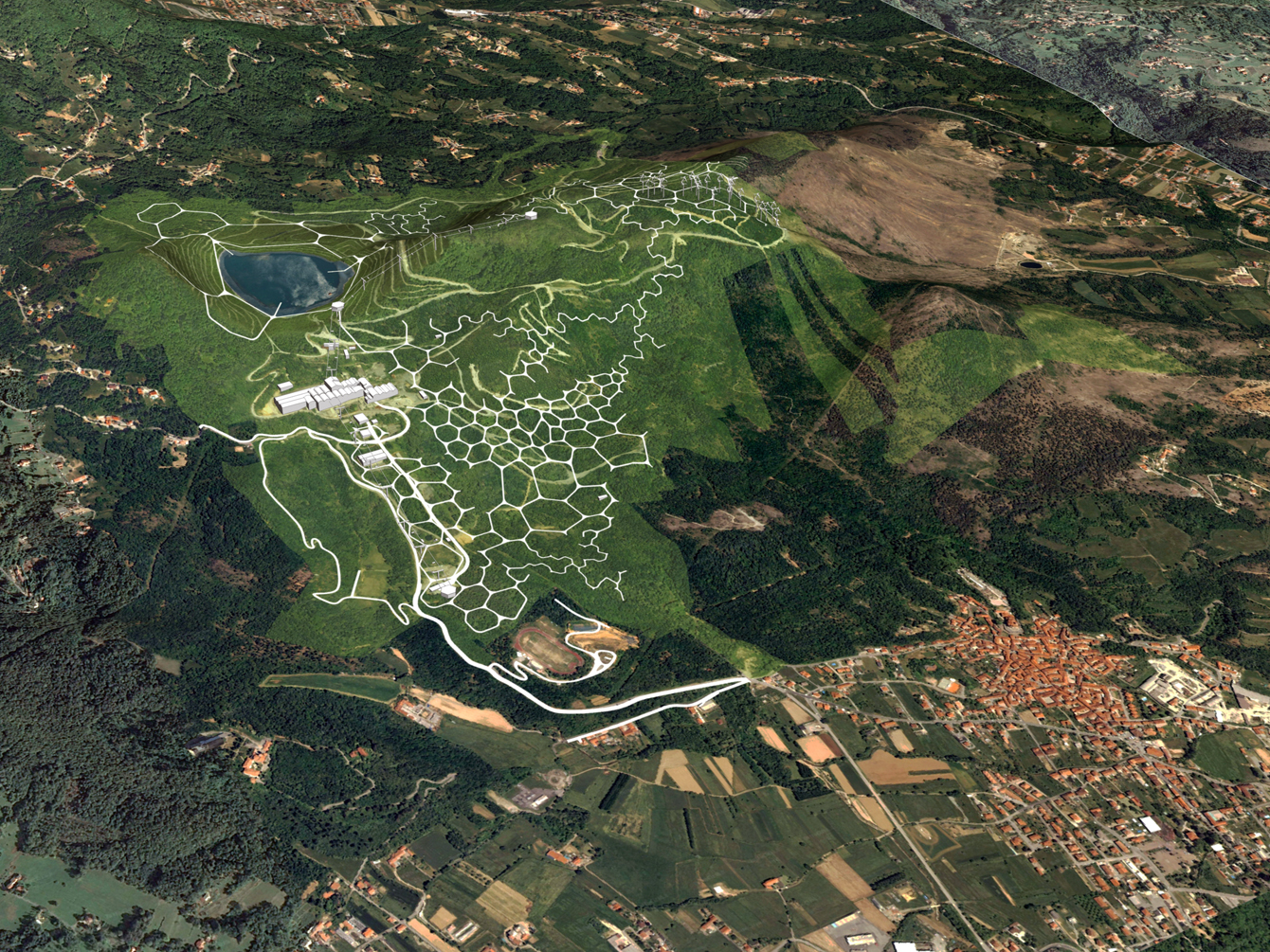
The 310 hectares of the site are organized through an irregular hexagonal grid that shapes both the zoning pattern and the paths network. The choice of the hexagonal geometry depends on the resulting balance between its high adaptability to this specific orography and its low invasiviness on the ground. At the same time, because of its irregularity, the proposed geometry follows the idea of a landscape with areas of different sizes governed by a soft and heterogeneous zoning structure. In fact, the hexagonal geometry allows the creation of a pattern through th infinite repetition of the generative element, its deformation, extension, and reduction, tolerating any incompleteness without losing its geometric identity: the susceptibility to the deformation of its regular geometry and its adaptability to the orographic system is the necessary characteristic for the visual and territorial representation of a complex and articulated program like the one expected for the planning and management of the area. The hexagonal link becomes a “physical tool” to colonize the territory and to carry out the strategy of the project.